Augmented Reality (AR), a technology that overlays digital information into the real world, is transforming various aspects of our lives, and education is no exception. One exciting application of AR in the educational context is campus navigation. In this blog post, we'll explore how universities and colleges can harness the benefits of AR using campus wayfinding.
Campus Navigation: Existing Challenges
Navigating a university campus, especially one of considerable size and complexity, presents numerous challenges for students, staff, and visitors alike. Traditional navigation methods, such as paper maps or GPS-based smartphone apps, often fall short of providing a seamless experience. Listed below are some of the critical challenges of campus navigation:
Complex Layouts
Many university campuses are like mini-cities, with numerous buildings, pathways, and facilities. The sheer size and complexity of the layouts can be overwhelming for new students who may need help finding their way around. This challenge is compounded by the fact that some buildings may look similar, too.
Inadequate Signage
Insufficient or unclear signage is a common problem on university campuses. Missing or poorly placed signs can leave students guessing about the direction they should take. This issue can be particularly frustrating for newcomers who are unfamiliar with the campus.
Construction and Renovations
Ongoing construction and renovations can disrupt established pathways and create temporary obstacles. Students and staff may find adapting to changing routes challenging and must plan their commutes more carefully.
Accessibility Concerns
People with disabilities may face additional challenges related to campus navigation. While many campuses have made improvements in terms of accessibility, some areas may still lack the necessary accommodations, such as ramps, elevators, or tactile indicators for those with visual impairments.
Time Management
Navigating a large campus can consume much time, especially if students have back-to-back classes in different locations. Poor campus navigation can result in delays, which can impact academic performance and cause stress.
Security Concerns
In some instances, students and visitors may feel unsafe when navigating certain areas of the campus, especially at night. Concerns about personal safety can influence students' choices of routes and transportation options.
AR Solutions for Campus Navigation
As mentioned above, the conventional university wayfinding signs and maps have limitations. However, recent technological advancements have opened up exciting possibilities for enhancing campus navigation through digital wayfinding solutions, particularly AR wayfinding. This includes:
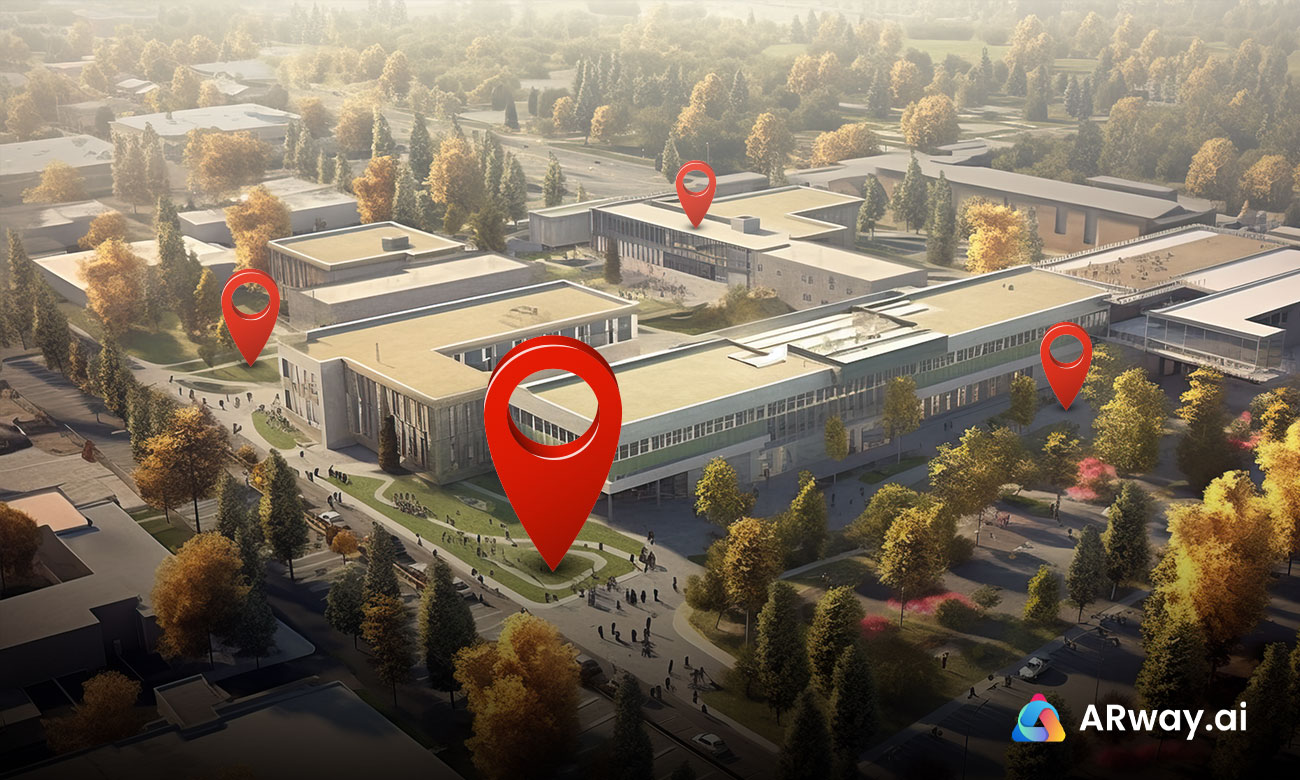
Interactive Campus Tours
One of the most exciting possibilities of AR in campus navigation is interactive campus tours. AR apps can offer students and visitors immersive campus tours by simply pointing their smartphones or wearing AR glasses. As they move through the campus, information about buildings, landmarks, and historical facts can be overlaid onto their view. It helps navigate and fosters a deeper connection to the campus's history and culture.
Live Navigation
AR navigation apps can provide real-time, turn-by-turn directions by overlaying digital markers and arrows onto the physical environment. Imagine walking on campus and seeing arrows leading you to your next class, the library, or the cafeteria, all while keeping your eyes up and aware of your surroundings. It reduces the risk of accidents and allows for a more engaging navigation experience.
Customized Information
AR can provide context-aware information based on a user's location. For example, when a student enters a library, the AR system can automatically display information about library hours, available study rooms, and recommended books or resources related to their courses. This personalization enhances the campus experience, making it more efficient and tailored to individual needs.
Augmented Event Calendars
Universities and colleges are hubs of activity, with numerous events, lectures, and gatherings happening daily. AR can enable students and visitors to access event calendars and receive real-time notifications about upcoming events near relevant venues. It promotes campus engagement and encourages participation in extracurricular activities and socialization.
To expand your knowledge on digital wayfinding please see What is Digital Wayfinding: Top 10 Benefits.
Key Benefits of Using AR Solutions for Campus Navigation
Research suggests that 71% of people experience better navigation with AR. By embracing this technology, universities and institutions can create a more efficient, engaging, and user-friendly campus environment. Key benefits include:
Enhanced User Experience
AR wayfinding makes the user experience more interactive and engaging. Instead of following static maps, you can receive dynamic directions that adapt to your current location and destination. This innovation simplifies navigation and enriches the experience of exploring the campus.
Accuracy and Precision
Traditional maps and signage can be confusing and imprecise, leading to frustration and wasted time. AR wayfinding offers unparalleled accuracy, ensuring users reach their destinations efficiently. The technology leverages GPS and sensors to precisely locate users and guide them along the most optimal routes.
Real-Time Navigation
Next, AR wayfinding solutions enable real-time navigation. Users receive step-by-step directions on their devices, with digital markers and arrows overlaid onto the physical environment. It eliminates the need to constantly check maps or screens, allowing users to navigate the campus confidently.
Personalized Assistance
Digital wayfinding has the potential to offer highly customized assistance. By integrating your schedule and preferences, the system can recommend the best routes to your classes, the library, or even the nearest coffee shop. This level of convenience encourages campus exploration.
Accessibility
AR wayfinding can enhance accessibility for all users, including those with disabilities. The technology can offer audio-based directions and descriptions for visually impaired individuals, ensuring that the campus is navigable by a broader range of people.
To learn more about the ‘Significance of Indoor Navigation for Accessibility’, click here.
Optimized Campus Design
The campus can benefit by implementing AR solutions. Administrators can gather valuable data on user traffic patterns and popular destinations, allowing them to optimize the layout and improve the overall flow of university wayfinding. It contributes to a more user-friendly and accessible environment.
According to a Global Market Insights Inc. report, the augmented reality market size is set to exceed USD 50 billion by 2024. AR-based campus navigation, powered by its benefits, is on the brink of transforming how we navigate educational institutions. The applications of AR have the potential to enhance the campus experience, improve accessibility, and foster innovation. As universities and colleges adopt this technology, they pave the way for smoother navigation and prepare their campuses for a more technologically integrated future.
About ARway.ai by Nextech3D.ai
Augmented Reality Experience Platform
ARway.ai is a powerful, no-code spatial computing platform that melds the real and the virtual into a seamless experience. One of its powerful features includes navigation and wayfinding that facilitates the creation of robust AR navigation with accurate positioning, digital directory, turn-by-turn, and optimized routes.
ARway Creator Portal
Create, manage, and track the performance of 3D maps and Augmented Reality Wayfinding experiences with no code. Key features of the ARway Creator Portal include:
1. Floorplans & LiDAR Scans
Configure spaces with floorplan images or LiDAR scans as schematics for remote visualization and authoring of spatial content.
2. Location Pins & Navigation
Improve navigation with AR wayfinding. Drop location pins at points of interest on your map to populate a directory of locations your visitors can navigate.
3. Map Management
Manage specifications, features, location-persistent content, and linkages of your maps. Generate QR codes and administer your visitor experience.
4. Guided Tours
Create turn-by-turn navigation paths populated with AR content to create engaging, curated tours for your visitors.
5. Analytics & Location Intelligence
Measure the performance of your maps and obtain critical insights into visitor behavior in your space.
6. Content Library
Populate a content library with images, audio files, 3D models, videos, and more to be published in spatial experiences as location-persistent content.
To learn more about this advanced AR navigation solution, contact us here.